
I live on the West Coast, in California, where earthquakes are common and tsunamis are mercifully rare – but that’s not to say they are unheard of. Before the next one arrives, I thought it would be a good idea to understand more about the interaction among earthquakes, faults, and that dreaded natural disaster – the tsunami.
◊
What Are Tsunamis?
Tsunamis hit with massive amounts of destructive force, laying waste to everything in their path. But what’s the definition of tsunamis, really? How do they form, why do they strike where they do, and is it possible to predict their occurrence and the paths they take?
One simple definition of tsunami is “an enormous sea wave that erupts and reaches land.” Another description is “a great sea wave produced especially by submarine earth movement or volcanic eruption.” But these definitions hardly do justice to the power of such an event.
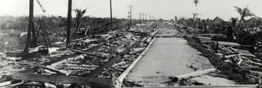
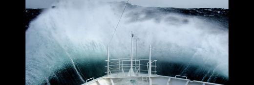
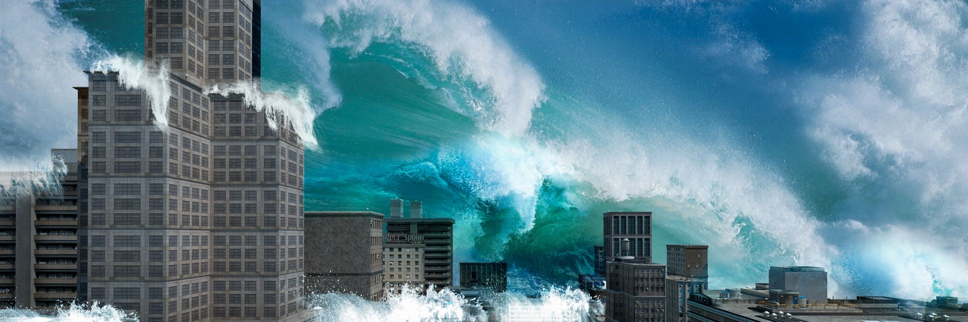
Tsunamis can be almost unimaginably huge walls of water that move with incredible speed – up to 500 miles per hour. They can devastate coastlines and low-lying areas, along with the lives and property of people who are in their way. The cost in human misery cannot be tallied, and the economic impact of a single tsunami event can easily run into billions of dollars.
How Do Tsunamis Form?
Underwater earthquakes are the primary cause of tsunamis. During such tremors, the ocean floor suddenly rises or falls. The resulting displacement of water causes a series of rolling waves along the entire length of the affected area, which can be more than 100 miles long. The enormous amount of water displaced by the disturbances produces hydroelectric energy that adds power and speed to the waves.
In the open ocean, the waves may be barely perceptible, as small as two feet high. But when they approach shallower waters along coastlines, the waves turn suddenly destructive, building height and ferocity until they crash into land as walls of raging water that can be more than 100 feet tall.
The largest tsunami ever recorded occurred in Lituya Bay, Alaska, on July 9, 1958. Due to a confluence of causes, it swelled to an awe-inspiring height of 1,720 feet. An earthquake hit along the Fairweather Fault in the Alaska Panhandle, causing a massive rockslide from 3,000 feet above sea level into the Gilbert Inlet that triggered the tsunami. The narrowness of the inlet was key to the extraordinary height of this event.
Why Are Tsunamis So Destructive?
Tsunamis are not just single waves. They create successive sheets of water that can rock coastal areas and travel inland for many miles. Scientists have estimated that the energy unleashed by a tsunami could power a city the size of Los Angeles for a year!
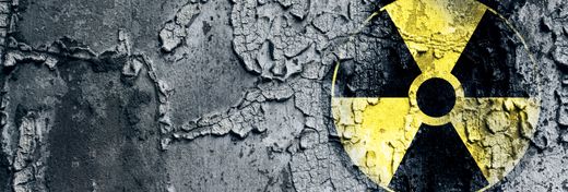
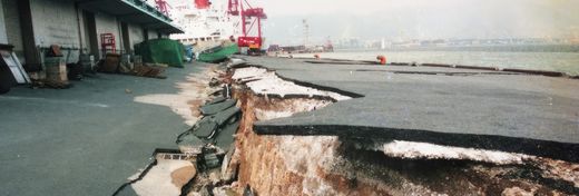
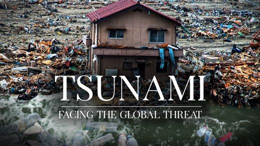
The most destructive tsunami in recorded history was the 2011 T?hoku event, better known as the Fukushima disaster that caused multiple nuclear meltdowns at the Fukushima Daiishi Nuclear Power Plant in Japan. This tragedy resulted in the loss of nearly 16,000 lives and the permanent relocation of more than 200,000 people, and it caused $235 billion in damages.
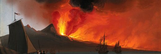
What Causes Underwater Earthquakes?
Earthquakes occurring under the ocean are most often caused by the movement of the plates that undergird our entire Earth. This motion, by definition called plate tectonics, never subsides. As the plates impact each other or separate, energy builds up and is eventually released in the form of earthquakes.
The entire crust, or deep surface, of the earth is composed of massive continental plates, 50 miles thick, that float on a bed of magma above the Earth’s core. This movement is exceedingly gradual, often as slow as two inches a year, or even less. Plates can produce tremors in several ways:
Three Ways Tectonic Plates Can Cause a Tsunami
- They can converge on one another, in which case the heavier (and usually older) plate will slip underneath the lighter plate. As the denser plate moves lower, it begins to break up and is consumed by magma, opening up an underwater trench.
- They can slide past each other without one sinking. In such cases, the irregular borders of plates may catch on each other.
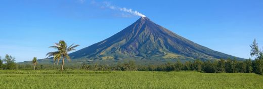
- Or two plates can diverge and move away from each other. When this happens, the space between the plates is filled with magma, which can rise to the surface in the form of an underwater volcano.
Want to be able to track undersea earthquakes as they are happening? Earthquake maps, available to view on the Internet, are a great source of up-to-the-second information. For a list of some of the best-known and most-trusted earthquake maps, click here.
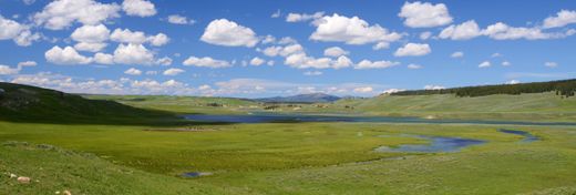
Where Are Tsunamis Most Likely to Form?
Earthquakes and tsunamis rarely form in the Atlantic Ocean, but they are more common and destructive in the Pacific and Indian oceans. For example, the devastating December 2004 earthquake centered off the west coast of Sumatra powerfully impacted Indonesia, India, Sri Lanka, Thailand, and many other countries, and caused numerous immense, destructive waves across the region. The toll in human life was unthinkable – more than 230,000 people died.
The Indian Ocean is an unusually active geologic region due to several factors. First, three tectonic plates meet in the center of the ocean, and pressures along the eastern edge of one of them – the Indo-Australian Plate – caused the earthquake that resulted in the 2004 tsunami. Also, geologists have reason to believe that there are also stresses within that plate that may be pulling it apart and creating a new plate in that region.
The “Ring of Fire”
Tsunamis are even more common in the Pacific Ocean. This is due to a highly active geologic area called the Ring of Fire that almost completely encircles Earth’s largest ocean. In this huge area, massive plates converge and diverge, causing deep trenches as well as volcanoes and earthquakes that result in tsunamis traveling in every direction.
Tsunamis: Wreaking Destruction from Under the Sea
In recent years, scientists have learned much about tsunamis. While there’s no way to prevent the destructive force of a tsunami, or to predict with any precision when a tsunami will occur, the technology of tsunami warnings has advanced to the point where lives may be saved by providing people a crucial measure of time to move inland and to higher ground. This may not seem like much, but when faced with the fury of nature at its most primal, it could be the best you and I can hope for.
Ω
Kevin Martin is Senior Writer for MagellanTV. He writes on a wide variety of topics, including outer space, the fine arts, and modern history. He has had a long career as a journalist and communications specialist with both nonprofit and for-profit organizations. He resides in Glendale, California.
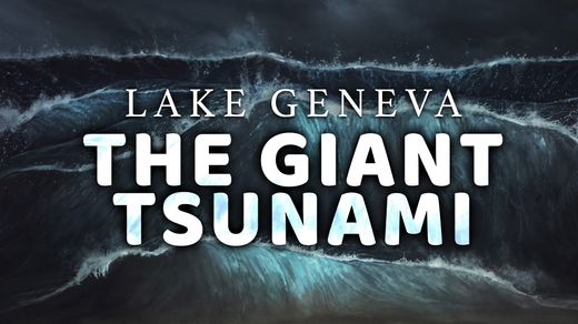
Title Image: tsunami v2 (Source: Mathias Weil, via Adobe Stock)